I usually make lots of photos anywhere I go. Even when I was visiting home in Tennessee a few months ago, I was snapping pictures like a Japanese tourist at the baggage claim of SFO. On arriving in a new place my hand starts twitching towards the pocket where my camera lives. But I was in Pakistan for more than two weeks before making my first photo. Partly that was because I've been working a lot and had seen nothing more than the route from the house where I am staying to the office. But it's also because Islamabad, the capital of Pakistan and my home base here, is rather dull.
You'd expect dusty streets full of carpet touts, dhal vendors, one-armed beggars, women with their faces covered, and AK-47 toting bandits. But instead you get tree lined streets in a perfect grid with large, vaguely Brady Bunch-ish houses. The place was planned and built from whole cloth in the 60s, and although very pleasant and safe, it's lacking in soul. It's about as western a city as I've seen outside the west; KFC, Dunkin Donuts, and funky cafes give it a familiar feel. In Islamabad, women dress however they like. Many cover their hair, but not their face. Most would not look out of place walking down any street in any city in the U.S.
Still though, it has some oddities that mark it clearly as part of the world where 'family values' still dominate in the public arena. There's a club in the basement of the Marriot hotel complete with dj and dancing, but if a couple gets touchy-feely, there's a bouncer/chaperone who comes around and separates them. And to buy any sort of booze in Pakistan, you have to have a license which you can only get if you are a "Christian". Because the assumption is that all white people are Christians, it works ok for westerners, but there are lots of Pakistani Christians. I'm not sure what they have to do to prove they are Christian and get some hooch.
Even in Islamabad, which is more than a hundred miles from the heavily affected areas of the earthquake, the scale of this massive geologic event can be felt. Everyone seems to know someone or have a family member who died. More than once when riding in a taxi, the driver has asked me about what I am doing here. When I mention that I am working in the earthquake response, he will tell me about his nephew or daughter or wife who was hurt or killed when the quake hit in early October. Around 75,000 people were killed, mostly by collapsing houses and shoddily built schools. Even here in Islmabad, a hotel collapsed, killing 40 people.
I've been to the field once, and will probably be going up again this week. Although there are some large towns, it is mostly rural and rugged, but by no means empty. These foothills of the Kharakoram range are covered in narrow, precipitous roads leading up the terraced slopes to quiet villages of stone-walled or concrete houses.

Villages strung like garland on the hillsides cover most of the affected area.
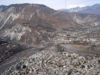
The town of Mansehra was damaged by the quake, but is mostly still standing.
Villages strung like garland on the hillsides cover most of the affected area.


Damage in Mansehra.
Houses with tin roofs are generally still standing (at least in the area where I visited; in other areas whole towns have been reduced to rubble). The traditionally constructed houses didn't fare so well. Roofs made from a layer of timber covered in earth (remarkably similar to traditional homes in Eritrea) make for good insulation, but are incredibly heavy and attached only by gravity to stone walls with no foundation. During the quake the earth shifted, the walls tipped, and roofs came down on their dwellers. My first site of a massive earthen roof flat on the ground, timbers sticking out from the edges like crayons from the box, was a shock. In other houses, the walls held, but the heavy roof caved in. And on the fringes of the disaster, where most homes withstood the shaking, schools, full of children, collapsed. Relief workers here in the first days after the quake talk about being able to identify the schools by the large numbers of people grieving by a pile of rubble.

This used to be a town.
Flying into and out of the area by helicopter, I looked down on thousands of tents. Some are white canvas tents in the familiar shape of something from the set of M.A.S.H. Others are blue or red plastic half-cylinders that look more like part of a moon colony. In some places they are scattered among the ruins of the towns, each tent adjacent to the pile of rubble for which it stands in. In other places camps have sprung up for those displaced by the disaster. Facing a winter without shelter in the high valleys of the Kharakoram (home to many of world's highest mountains), hundreds of thousands have descended, destitute, seeking help. Others stayed put for fear of losing their land if they left it. Predictions were that many would die in the winter, but the winter storms were late this year, allowing the relief effort to deploy lots of shelters, and so far it has been mild for a Himalayan winter. It seems odd to me, though not surprising, that people here are quick to thank God for this meteorological blessing when they won't blame him for the geological curse of the quake.
The relief effort is simply amazing. More than 80 agencies are directly involved. Government agencies from around the world, UN agencies, and NGOs (Muslim, Christian, and Secular) have swarmed the place. Around 40 helicopters spend all day carrying loads of relief goods into the remote valleys and god-knows-how-many of the fabulously decorated jingle trucks shuttle goods on the roads. These efforts are constantly hampered by landslides as the mountains shake off the dust of the earthquake and settle themselves back to sleep (we hope). And when the winter storms roll through, pretty much nothing moves until the road clearance teams (mostly Pakistani military) can get to work.

My favorite things in Pakistan are the jingle trucks. Every one is a unique work of art and they are the workhorses of the relief effort.

Another jingle truck.

And when the terrain is too rough for jingle trucks, jingle tractors take over.

Many villages are only reachable by foot, so the shelter materials, including the heavy corrugated iron sheets you see here, have to go up on foot.
Most relief workers live in camps run by different agencies. They sleep in large, crowded tents, some camps have good showers and food, some don't.
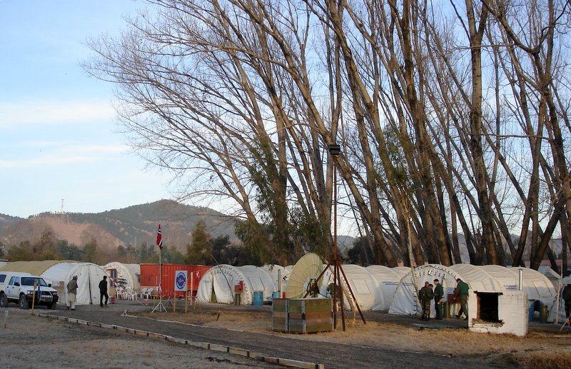
The Abbotabad base camp is run by the Norwegians. Quite comfy with heated tents and hot showers. No privacy, though. And because this is where the helicopters live, it's pretty loud when they all depart in the morning.

Like I said, not much privacy.

Rise and shine at the heli base. It's impressive when half a dozen big helicopters are preparing to take off.
Such was the scale of this disaster than only now are people beginnig to think about reconstruction and recovery. Until now, the effort has been 100 percent focussed on delivering food and shelter to people to keep them alive through the winter. Many thousands of tons of corrugated iron sheets, foam insulation, bed mats, stoves, cook kits, hygiene kits, clothing, and food have been delivered. Those efforts continue.

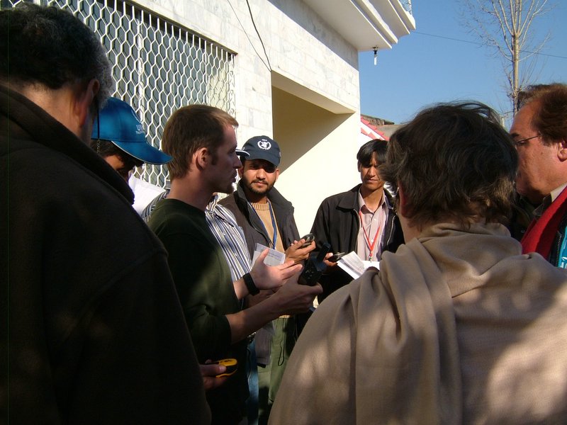
My friend Jasper, who I met in Eritrea, is now here working with an NGO to distribute shelters. Here he's assessing a village to determine how many shelters will need to be built. The areas below the snowline are just now getting help because the early focus was to help the people up high before winter arrived.
Trying to manage the chaos of 80 plus agencies delivering all this stuff to thousands of villages is daunting, but it's the role of the agency that I work for, the UN Joint Logistics Center. The team of 3 GIS guys that I am part of is charged with mapping the locations of warehouses, roads, helicopter landing zones, landslides, road closures, bridge conditions and anything else that affects the ability of all these agencies to deliver all their stuff. We collect, collate, and disseminate daily maps of road conditions. We are working to create analytical maps showing what stuff has gone where, though as you might imagine it is difficult to get that information back from the field. My main job at the moment is training teams in the field to collect GPS road data while they go about their usual tasks and then to get that data onto our maps. A team from the Univeristy of Georgia is helping with all the data editing required to do that.

A main road. This one is in good shape.

Many bridges survived, but they're still a bit scary to drive across.
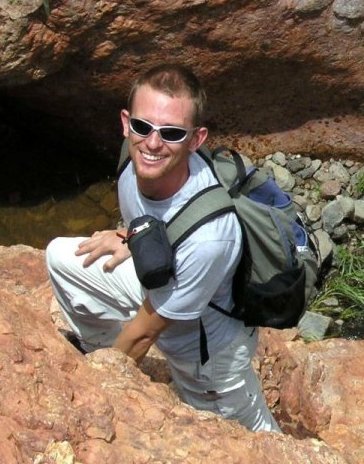
Me, preaching the gospel of GPS.
The work hours are long. We work seven days a week, usually between 10 and 12 hours per day. Often more. I share a house with the other two GIS guys, so it's pretty much work from the breakfast table to the dinner table. We each have laptops so we can work anywhere. It's intense, but when you enjoy the work, feel like the outputs of your effort are valuable, and enjoy the people that you work with, it's not so bad. And barring another bit of geological nastiness somewhere in the world, I should get a few months off after this is over in April or May.
Be well,
cj